Sunday, May 15, 2016

Introduction

Canberra Centenary Trail (or something like it)

The route I took comes to just about 135km. I deviated from the marked CCT on a number of occasions, either deliberately to climb adjacent hills, or inadvertently due to poor signage or inattention, or both. This map shows my entire route, as recorded in Orux tracklogs imported to Google Maps.


I set out with the intention of completing the walk in a week. It ended up taking 15 days, although I only walked the CCT on seven of them. What interrupted the walk were a couple of days I had medical appointments, a day I had the car booked in for a service (and went for a bike ride around the lake), a couple of regular bushwalks, and a couple of rest days. All told, it took some 38.5 hours of walking, including stops.

The walking turned out to be more challenging than I'd anticipated, but I attribute that at least in part to the numerous detours I took to climb hills. On the days I piked after a short distance, my feet were so sore that it really would have been an unpleasant slog to have proceeded any further. I don't know if I have the wrong boots, or the wrong feet, or am just too much of a wooss.

The logistics of walking the CCT alone are formidable. It is apparently possible to do it using public transport, although I don't think there is an Action bus service to Hall. In any case, that can add up to 90 minutes of extra travel at each end of the day, apart from some additional walking. Walking with others and doing a car shuffle can also be time consuming. The reason I could do it the way I did, stopping whenever I pleased, was that my friend Jo agreed to get up and drive me to my starting point and pick me up wherever I got to. I doubt I'd have ever considered undertaking it without the prospect of her support.
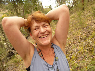
Jo

Much of the trail is exposed, and it's probably more exposed than I think because most of my deviations took me through woodier areas with some shade. The bad news is you can get quite a sunburn. The good news is you get almost uninterrupted panoramas of the Brindabella and Tidbinbilla Ranges, along with nearer hills and landmarks, when the weather is clear, as it often is.

A large proportion of the CCT follows 'dual use' cyclepaths. These are not my preferred surface for walking as they can be quite boring. When forced to follow one, I walk on the verge alongside it as much as surrounding shrubbery permits, especially when wearing earphones, and definitely if I stop for any reason. Oblivious pedestrians can be a real hazard on the cyclepaths.

The signage along the CCT is sometimes quite adequate, with readily visible and unambiguous markers at every junction. Elsewhere it can be confusing. My preference for a trail like this would be to ensure that every intersection was unambiguously marked, especially around road crossings, with reassuring markers periodically along the way. It would be way better if each sign, or at least every once in a while, indicated the direction it was heading. They could show the name of the next roadhead, and even the remaining distance, or at least indicate whether you were going clockwise or anticlockwise.

As others have remarked, the trail is a bit of a compromise because of the desire to make it negotiable by mountain bike, which means avoiding some rougher sections and pretty well every hill. As a matter of fact, it might be possible to do on a road bike, although there are some loose sections. It would be good if there were marked pedestrian detours to take in the hills, while avoiding fences! There are other aspects of the route that struck me as inexplicable, as mentioned as we go along.

Because I had walked sections of the trail before, and because David Briese took so many, in good conditions, that I liked, I didn't take many photos. Most of the images in this account are the photo waypoints I recorded in Orux Maps. There are some other images here.

This map shows the official route.

http://www.tams.act.gov.au/parks-conservation/parks-and-reserves/find-a-park/rural/canberra-centenary-trail/canberra-centenary-trail-map

Stage 1: Watson to Red Hill Lookout

Stage 1 
Tuesday 2016 03 29
Federal Highway west of Horse Park Drive, Watson to Red Hill Lookout
19.16km, 615m ascent

(Corresponds to Section 1 and part of Section 7)

Coincidentally, the place I decided to set out from was right at the gate of a property Jo used to rent. There is a big underpass under the highway and the signs lead around the west side of Mt Majura.

So I left the trail within the first kilometre to climb the hill. I had a little yarn with a visitor I met on top. It took about an hour to get from there to Mt Ainslie.
Majura Trig

I followed what I think of as 'The Main Trail' down to the War Memorial and walked all the way around trying to find the cafe, having eaten and drunk nothing so far that day. I had a coffee and a muffin at Poppy's, at an exhorbitant price.

I think I understand why they decided to route the trail down ANZAC Parade, but if I did it again, I think I'd try continuing SE through the Mt Ainslie reserve, crossing Fairbairn Ave, and down the east side of Campbell through the Mt Pleasant reserve, crossing Morshead Drive just east of Russell, and making my way back to the King's Ave Bridge from that side. Anyway, I followed the nature strip along the service road and made my way to the lake, where I picked the trail up again and followed it over Kings Ave Bridge, along the lake, past the National Gallery and High Court, up 'Reconciliation Place', past the Tent Embassy and Old Parliament House to the Federation Stone at New Parliament House, the nominal start and end point of the CCT.
Federation stone

I walked around the west side of Parliament House and stopped on some steps overlooking a small football field for my afternoon tea.

From there, I hobbled down Melbourne Ave to Red Hill. Adjacent to the Canberra Nature Park sign at the bottom of Red Hill road, there is a break in the fence. I went through it and pretty well straight up the hill. The coffee shop and the restaurant were both closed, much to my chagrin. So I drank some lukewarm tea while I waited for Jo.
Red Hill Lookout


Stage 2: Red Hill to Tuggernanong

Stage 2
Thursday 2016 03 31
Red Hill Lookout to Tuggeranong Town Centre
19.54km, about 1000m ascent
(Corresponds to part of Section 7)


As I had done a fairly strenuous walk up Pig Hill on Monday, I intended to have a break on Wednesday from the outset.

On Thursday morning, the cafe at Red Hill was still closed, opening at 9, I think.

My objective was to get at least to Tuggeranong, and hoped to make it to Kambah Pool.

I set off south along the ridge and before long the trail descends down the east side and meanders around the suburb of Red Hill  before crossing Hindmarsh Drive and skirting Mt Mugga Mugga on the east, along Mugga Lane. I continued along the ridge to Davidson's Trig,
Davidson's Trig
Quarry on Mt Mugga Mugga
Isaacs Trig
Wanniassa Trig
then descended to Hindmarsh Drive, found an entrance and went up the hill, following the edge of the old quarry around, then down the south side and up Isaacs Ridge to the trig.
   I continued along the ridge to Long Gully Road, where I caught the trail and soon left it again to climb Wanniassa Hill.

I decided to forego Farrer Trig and Mt Taylor, although on reflection, they would make a good detour and avoid Isabella Dr.

My intention was to come down off Wanniassa Hill and follow Erindale Dr the rest of the way into Tuggeranong Town Centre, but I ended up wandering around the back streets of Gowrie until I got to Isabella Dr, where I picked the trail back up.

While walking along the cyclepath paralleling Isabella Dr, a guy on the bike path rode up, apologised for disturbing me, and looked for a geocache in the tree I was sitting under doing something with my phone. He said, 'if you like walking, you should come along with the Canberra Bushwalkers.' I told him I was with the other mob - the Brindabella Bushwalkers. He introduced himself as John Evans. I told him I was Harry. He asks, 'You're not Harry The Photographer?' I said, 'I don't think so.' He says, 'The guy who sends links to photos around to the Wednesday Walks list?' I said, 'Yeah, that's me.' Anyway, he thanked me for sharing the links and I was pretty choofed. I regret not asking him about geocaching. It looks interesting. I must remember to look it up.

When I got to Tuggernaong, I was disappointed to find all the cafes shut, except Little Istanbul, where I procured quite an acceptable iced coffee, exactly what I'd, apparently inadvisably, allowed myself to develop a craving for.

Stage 3: Tuggeranong to Kambah Pool

Stage 3
Friday 2016 04 01
Tuggeranong Town Centre to Kambah Pool
8.51km, negligible ascent
(Corresponds to part of Section 6.)

The plan for the day was to get at least as far as Mt Stromlo, although I hoped to make Black Mountain, or at least the Arboretum. As it turned out, the easy walk past the wall and through Red Rocks Gorge to Kambah pool was no problem, but by the time I arrived my feet were so sore, I decided to swallow my pride and call it a day.
Tuggeranong stone wall

Stage 4: Kambah Pool to Dairy Farmer's Hill

Stage 4
Wednesday 2016 04 06
Kambah Pool to Dairy Farmer's Hill
29.05km, 1155m ascent
(Corresponds to parts of Section 6 and Section 5.)

Jo wasn't available on the Saturday and I went with the club to Serenity Rock on Sunday. On Monday, I had an appointment, and Tuesday I helped Jo and her friend clean out the friend's son's house for a new tenant.

I'd forgotten that the Easy Wednesday walk was Red Rocks Gorge, retracing part of my route from Friday. I expected to set off about 7:30, but it was nearly 8:30 by the time we got to Kambah Pool and checked out the other end and stuff. So there they all were. I had a little yarn with one of the easy walkers and headed off.

I was not looking forward to the 6km slog up Kambah Pool Road, but it was not as bad as I'd feared, although almost entirely exposed, and I ended up leaving the trail after only about 3km to climb MacQuoid's Hill. According to the Canberra Nature Park map, there's a pedestrian entrance at the very southwestern corner of the reserve, but I didn't know that and ripped my shorts on a barbed wire fence. What's worse is that it was such an easy fence – and I was consequently careless.

View west from MacQuoid's Hill
Arawang Trig

The country is pretty bare, so I just made a beeline for Mt Arawang,
where I stopped for morning tea. I think I picked up the trail at the bottom and followed it along Cooleman Ridge to the Trig, which is off the trail. Much of the way, Chapman is nearby. I left the trail again to ascend Narrabundah Hill, where I stopped for lunch and returned to the trail past Duffy. I left the trail again at Cotter Road to climb Mt Stromlo. I was out of water at this point and was looking forward to refilling my bottles, and possibly a coffee, at the top. After wandering around for quite a while, I found a working standpipe. Eventually, I got the bright idea of looking the cafe up and surprise, surprise...'permanently closed'.
Narrabundah Trig
Stromlo Trig


After descending the east side of Stromlo, I eventually found Stromlo Forest Park. The trail between Cotter Road and the Arboretum is marked as 'Short term alignment' on the CCT map. I didn't see any CCT markers leading away from the big information sign with the map. I considered skirting Wright and Coombs on the north, but was concerned about crossing the river. I ended up walking along a cyclepath adjacent to Cotter Road along the south side of Molonglo until I spotted a firetrail heading northwards, east of Coombs. That took me directly to a causeway across the river and into the outer reaches of the Arboretum. With the benefit of hindsight, I'd probably have done better following my instincts, and bypassing Stromlo Forest Park entirely. But I was interested to see what was there – basically cycling facilities, apparently not used on a Wednesday afternoon. I once saw a coffee van there, but that was at the weekend. From there, the obvious route is actually more or less directly NE through the Molonglo suburbs to the firetrail heading north on the opposite side of Coombs. Having gone all the way back to Cotter Road, the route I ended up taking is probably best, certainly preferable to taking Lady Denman Drive across Scrivener Dam, as shown on the map.

The firetrails through the Arboretum are not the most direct route to Dairy Farmer's Hill, but at this stage, I just followed them until I got within about a kilometre of the top and rang Jo, asking her to pick me up in 15 minutes. As I neared the base of the hill, it occurred to me to ring and ask her to meet me at the entrance and save the hill for the next day, but reckoned she'd be driving and couldn't answer her phone anyway, and somehow made it to the top, on time.

Stage 5: Dairy Farmer's Hill to Australian Institute of Sport

Stage 5
Thursday 2016 04 07
Dairy Farmer's Hill to Australian Institute of Sport
12.95km, 527m ascent
(Corresponds to parts of Section 5 and Section 4.)

The next day, I hoped to get to Hall, but only made it as far as the Australian Institute of Sport in Bruce before the feet gave out again.

Coming down Dairy Farmer's Hill, I made a mistake and headed straight for the Arboretum gate. I should have picked the trail up at the visitors' centre and left via the cork plantation. That looks like a much nicer route than the one I ended up taking. At the gate, there are CCT markers going in both directions. I ended up following a cyclepath on the wrong side of Parkes Way. When I cut across the nature strip, I made an astonishing discovery! When they spray the blackberries, they die and the leaves fall off, making them much harder to spot in the long grass. The thorns do not fall off.

After somehow negotiating the Glenloch Interchange, I found a way into the park at the SW corner of Black Mountain. I followed a firetrail paralleling Caswell Drive until I came to a clear path heading up the hill, eventually rejoining the trail.
Black Mountain Tower

The signage on top of Black Mountain was again confusing, but I made my way down the east side to Frith Road and just continued on the trail along O'Connor Ridge near the Gungahlin Drive Extension. At one point, there is a sign 'Access to Bruce Ridge', or words to that effect. With the benefit of hindsight, I probably should have gone that way, because a little further up Bruce Ridge is exactly where the trail goes, after meandering all over the Institute of Sport, which, doubtless to it's credit, has coffee at much more reasonable prices than Poppy's.

I finished my tea while I waited for Jo to pick me up.

Stage 6: Australian Institute of Sport to Hall Village

Stage 6
Friday 2016 04 08
Australian Institute of Sport to Hall Village
17.4km, 493m ascent
(Corresponds to part of Section 4.)

Today. I managed to achieve my objective. Once you pass Hall there is no opportunity for a pick up for another 16 or 18km, so I never had any intention of going any further.

It was pretty flat, apart from Gossan Hill and Percy's Hill, and mainly followed bicycle tracks. It would have been pretty tedious, but I remembered to plug in the earphones and enjoyed walking with Wes Montgomery, the Red Norvo Trio, Mingus, Hendrix, Cream. I ran into a Canadian couple with some visitors from Canada on Percy's. The guy is an ANU geologist and coaches ice hockey. He knows Ali. Small town.
Gossan Hill
Percy's Trig
For some reason, the trail detours from its route alongside the Barton Highway to walk the length of O'Hanlon Pl in Gold Creek Village, where there are ample cafes that didn't interest me at the time.

Just before the trail crosses Clarrie Hermes Drive, the CCT markers appear to direct you north along the cyclepath, but when it started veering east, I had second thoughts and followed the road back to the trail, turning right a few metres further on into Victoria St, which takes you into Hall. While waiting for Jo, I had my boiled eggs accompanied by excellent battered chips and a decent double espresso from Daughter's Cafe, just beyond the Wood Duck Inn.